Permit Drawings + Site Maps
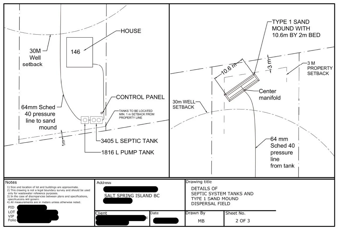
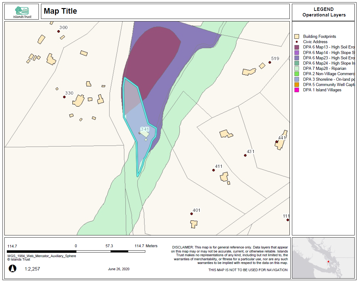
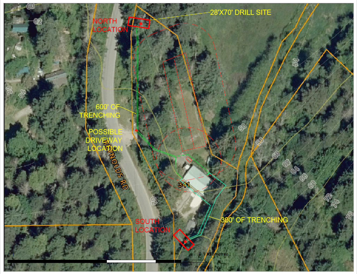
I can provide accurate scaled drawings required for building permits, detailed site maps, as well as permit applications with the Islands Trust and CRD.
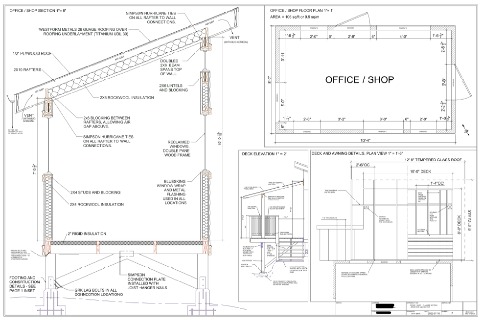
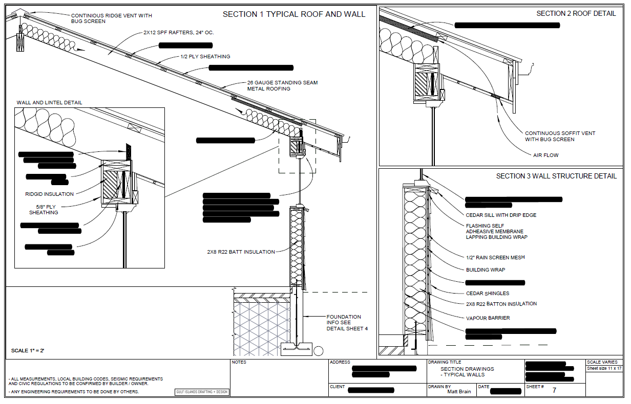
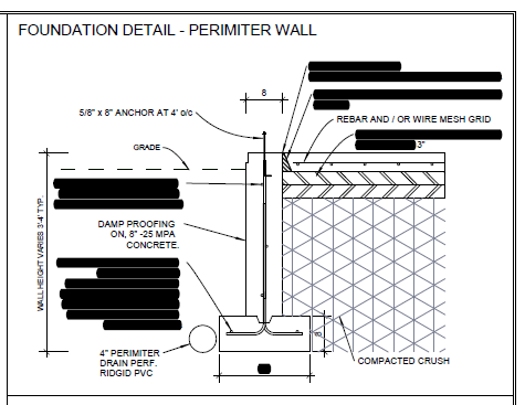
Building permit applications require drawings showing plan, elevation and cross-sections of walls, and foundations for intended work. If you don’t have any existing plans for your home, I can complete an FOI (freedom of information) request with the CRD to see what plans have been documented in the past, this can be a good shortcut if new plans are needed to show a buildings current state.
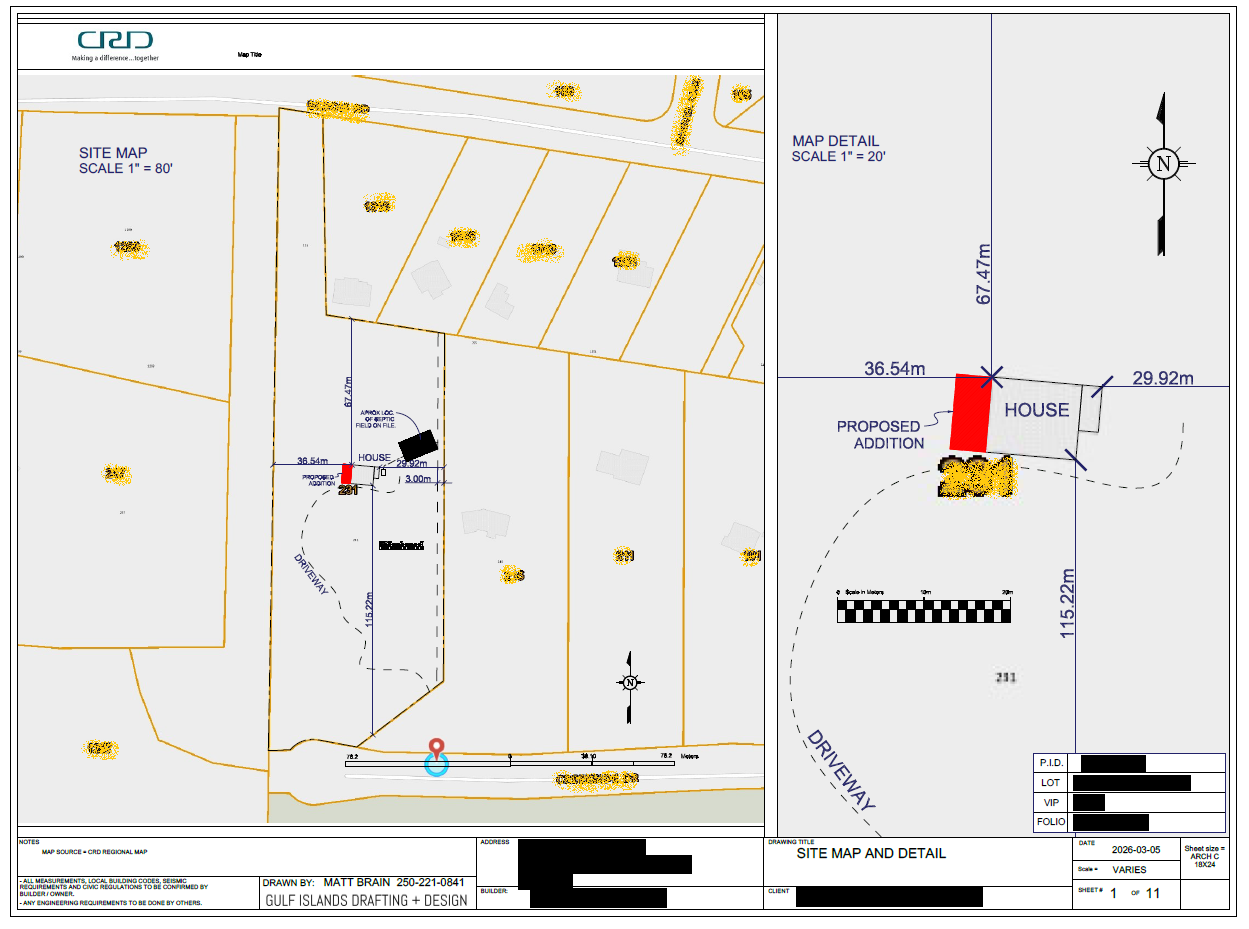
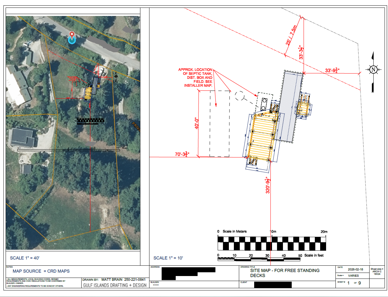
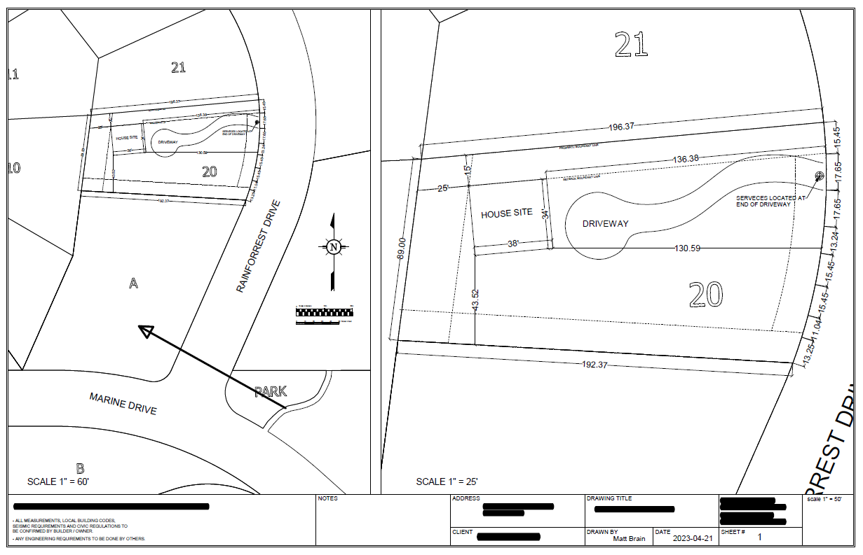
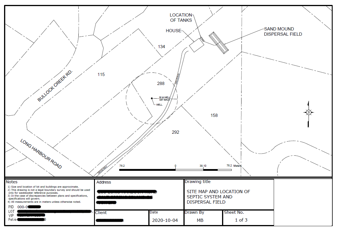
I can supply drawings needed for permits, scaled in the correct format as well as site maps required, showing property boundaries and setbacks.